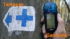
turistautak.hu térképrészleteK+ jelzés GPS-szel
[ english
Előzmények

SagiKhozzászólásai | válasz erre | 2007.03.08 08:30:50 (15119)
Mapsource

Changes made from version 6.11.6 to 6.12.2:

Changed the default file format to GDB version 3.
Added web links. This feature allows user created internet search options to appear on context menus. These search options can use either location or name information.
Added a MiniMap.
Added new waypoint symbols (contacts, geocache, hunting, etc.).
Added support for multiple links on waypoints, routes, and tracks.
Added additional guidance for the user when clicking on the 'View in Google Earth' menu item.
Added support for writing waypoints, routes, and tracks to SD cards for new chart plotters.
Enhanced the driving directions page in the route dialog to provide additional statistics.
Added a notes area to the route dialog. These notes are printed with driving directions.
Added two options to the routing preference 'Try to Avoid' list: ferries and seasonal road closures.
Added support for multi-line comments for waypoints.
Added a transfer preference to specify if (and which) serial ports should be searched for Garmin devices. This should solve problems for users that have badly behaved internal modems that cause MapSource to hang.
Added the ability to join tracks from the Tracks page.
Added track color to the list on the Tracks page.
Changed the behavior of the track draw tool to populate the elevation in tracks if the map product has DEM elevation data.
Changed several feature symbols (mountain peak, city, and airport) to be smaller so they don't obscure as much of the map. This only applies when the large symbol size is selected.
Adjusted the layout of several preference pages for improved usability.
Changed the behavior of several dialogs to ignore the degree symbol in user provided coordinate strings.
Fixed an issue when selecting map sets larger than 4 GB in size.
Fixed an issue with saving files to offline network drives.
Fixed an issue with preserving line feeds inside of comments in GPX files.
Fixed an issue with printing when the 'No Map' product is selected.
Fixed some line rendering issues on Blue Chart map products.
Fixed an issue with some postal code address searches not finding results.
[előzmény: (15118) SagiK, 2007.03.08 07:57:17]

SagiKhozzászólásai | válasz erre | 2007.03.08 07:57:17 (15118)
Lehet, hogy csak nekem újdonság:
60CSx új fw

Changes made from version 3.10 to 3.20:

Updated daylight saving time dates.
Add capability for 2 wide data fields on map, compass, and highway pages.
Add capability for 1 wide data field on map page.
Added data card information page.
Add selectable alarms for proximity waypoints and custom POI.
Improve labeling and scanning of custom POI on the map page.
Address issue where custom POI finder would erroneously produce no results.
Add capability to see vertical profile of an autoroute using DEM topo data.
Fixed issue with incorrect dates showing when editing the date field for Sun & Moon page and Hunt & Fish page.
Fix issue where invalid find menu options could show when using the Auto Order feature.
Fix issue with the Swiss grid providing incorrect coordinates.
Fix issue where route names would be converted to upper case during editing.
Update data card driver to support SD version 2 cards.
Corrected problem with NMEA input that could corrupt Waypoint names in WPL sentences.


Bejelentkezés név:  jelszó:   tárolás [regisztráció]

Felhasználónevedet és jelszavadat a geocaching.hu oldalon is használhatod!

[ kezdőlap ] [ térkép ] [ + felmérések ~ ] [ + útvonalak ~ ] [ + poi ~ ] [ belépés ] [ faq ] [fórum] [email]

A weboldal működése és tartalma folyamatos fejlesztés alatt áll, köszönettel vesszük az észrevételeket a fejlesztési ötletek oldalon.
A turistautak.hu-ra feltöltött track-eket és a letölthető térképeket, azaz térképi adatbázist az ODbL licencnek megfelelően bárki használhatja.
Minden egyéb anyag előzetes írásbeli engedély nélkül csak magáncélra használható fel. jogi tudnivalók